One of the first problems I encountered when I tried to make autogen for Nantucket is the lack of vector data for the vegetation. OpenStreetMap contains hardly any vegetation and also the GIS department of Massachusetts has not much usable data.
So therefore I started to experiment with detecting the vegetation in the imagery. And while playing with this idea, a similar tool popped up at the FSDeveloper forum.
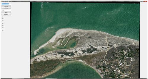
The approach I am testing now is to check the histogram of a small part of the imagery and based on the average value and the standard deviation decide what is forest and what not. I have made a small test tool to see which algorithm works best. Below you see a screenshot of the imagery and the detected vegetation.
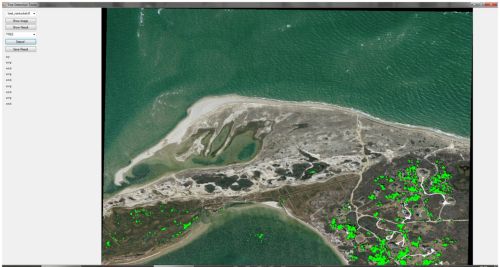
Of course it is not yet perfect. As you can see some vegetation ends up in the water for example. I have already seen that different images sometimes need different settings to get the right result. I am thinking about turning my test tool into some kind of configure tool. Hopefully if as a user you click on some areas that are vegetation and some areas that are not, I can have the tool figure out the best filter for that type of imagery.
Once I find an algorithm that works OK, I plan to put this functionality in scenProc as well of course. But for now there is more testing and exploring to do.
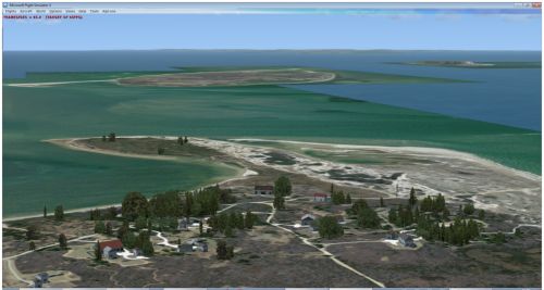
Below is a quick screenshot of the result I got now in FSX. I think it is not too bad, but there are still some bugs left. And I might have to pick a different type of tree to match the Nantucket area better.